

This map and its associated instructions have been cheerfully
plagiarised from a leaflet printed in 1994 by Aston Abbotts Parish
Council and Bucks County Council to celebrate a centenary of civil
Local Government.
Length: 1.5 miles
Waymarking: Originally the route was waymarked with the village
walk logo and yellow arrows. Most of these survive, but some are
badly faded now.
The Going:
Mainly level, no steep hills. About 50% walking on grass.
Five stiles to be negotiated.

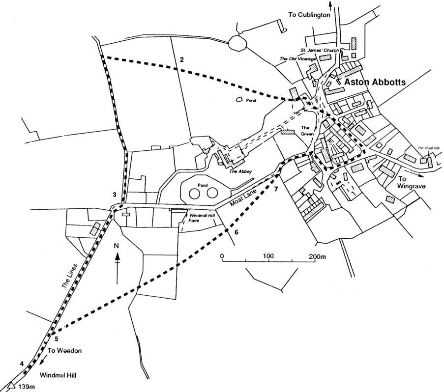
1.
Starting at the Green opposite the thatched lodge by the wrought
iron gates, proceed to the Grove past the old chapel erected in
1839 now converted to houses (on your right). Pass through the
kissing gate and continue to the next kissing gate in the iron fence,
keeping the little overgrown pond on your left. Over to your left is
a fine view of the Abbey, once owned by the Abbott of St. Albans
until the dissolution of monasteries in the reign of Henry VIII The
19th-century navigator and discoverer of the magnetic pole, Rear-
Admiral Sir James Clark Ross, once lived at the Abbey and lies
buried in the village churchyard. Not visible from the walk are the
two lake islands he named Erebus and Terror after the two ships he
took on a voyage of exploration to the Antarctic between 1839 and
1843. During the Second World War, Dr. Eduard Benes, former
President of Czechoslovakia and leader of its government-in-exile,
found refuge at the Abbey.
2.
Continue to the next iron fence, cross that stile and turn left along
Norduck Lane.
3.
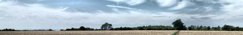
Turn right into Moat Lane, through the gate to Lines Hill with
panoramic views across the Vale of Aylesbury and the Chilterns.
Wingrave Church, County Hall Coombe Hill Monument and
Hardwick Church can be seen along the skyline.
4.
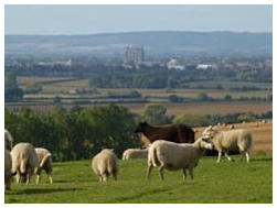
At the footpath sign on Lines Hill continue on for a short distance to
the Trig Point standing 450ft above sea level [note: the concrete
trig point marker has been removed and now resides in the village
orchard], and look to your left to see the outlines of the medieval
village of Burston in a field beyond the old farm house. Named
Birdstane in the Domesday book, the villagers were summarily
evicted and the houses demolished by the Lord of the manor. He
had decided to raise sheep on land which the villagers had always
cultivated in common. The land has probably never been ploughed
since then, so the foundations of houses and wall are clearly visible
as humps in the ground - especially when the sun is low. The
Science Museum in London has a model of the Burston remains, to
show how oblique lighting can reveal sites of archaeological
interest.
5.
Return to the footpath sign, cross the stile and make for the white
gate and stile. Cross the stile and, keeping Windmill Hill Barns
(now transformed into private dwellings) on your left, cross the
stile in the hedgerow at the end of the orchard.
6.
Proceed towards the white gate in the top left hand corner of the
field, noting the different species of wild grasses and flowers at
different times of year.
7.
Cross the stile and turn right towards the village and right again at
the junctions of the Green and Moat Lane, passing the Old House
and the entrance to Bricstock (so named because it was once
believed to be a stacking place for locally made bricks), now a cul-
de-sac for old peoples bungalows surrounding the recreation
ground. Along this section of the route you will pass several blocks
of houses dated 1854 and now tastefully modernised, and the now
closed village shop can still be seen at the right hand end of the
Old Cottage, the oldest building in the village dating back to 1540.
Bear left passing the former Bull & Butcher pub (now Humphreys
Close), and return to the Green. Alternatively turn right at The Old
Cottage and proceed down the Wingrave Road for 150 metres until
you turn a left hand bend Here you will will find the Royal Oak
thatched pub which, unfortunately, has remained closed since the
pandemic.
When in the countryside please follow the Country Code
Enjoy the countryside and respect its life and work
Guard against all risk of fire
Fasten all gates
Keep your dogs under close control
Use gates and stiles to cross fences, hedges and walls
Leave livestock. crops and machinery alone
Take your litter home
Help to keep all water clean
Protect wildlife, plants and trees
Take special care on country roads
Make no unnecessary noise
LEAVE ONLY YOUR FOOTPRINTS
TAKE ONLY PHOTOGRAPHS
So What’s So Special? Where Are We? Today & Housing Facilities, Industry, Threats The Village Walk Footpaths & Bridleways Field Map


- Photos
- Aston Abbotts - Winter Pictures
- Aston Abbotts How It Was
- Villagers Pictures - General
- Villagers Pictures - Ken Rhodie
- 630 Club Bean Competition 2011
- Astonbury X 2011 - Page 1
- Astonbury X 2011 - Page 2
- Astonbury X 2011 - Page 3
- Vic Scott Memorial Orchard
- Christmas Lunch 2011
- Peter Kent's Photographs
- Jubilee Picnic 2012
- Village Orchard - One Year On
- Village Orchard - Autum 2012 Planting
- Astonbury 2012
- Videos
- Interviews

