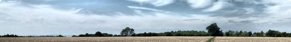


Aston Abbotts lies about five miles northeast of Aylesbury, in
central Buckinghamshire. From its elevated position around 468 ft
above sea level it affords lovely views to west across the Vale of
Aylesbury. To the South you can see the Chiltern Hills. These views
are best appreciated from Lines Hill, on the Western fringe of the
village.
The population Census of 2021 recorded a population for Aston
Abbotts of 426. These people occupy roughly 160 dwellings, mainly
in the central village but some in remote outcrops and farms,
including the hamlet of Burston.
There are three roads into Aston Abbotts all of which are
unclassified (in England an unclassified road is a relatively small
road or a Lane). The road to the south connects Aston Abbotts to
the main Aylesbury to Leighton Buzzard trunk road, the A418,
which passes about half a mile from the village. The road to the
north meanders past some farms until it reaches Cublington, a
similarly sized village about a mile and a half away. The road that
leads west out of the village winds down the steep Lines Hill
(named after a farmer who farmed there some 200 years ago) past
Burston and Lower Burston Farm, the site of an earlier Saxon
settlement which was eventually absorbed into Aston Abbotts, until
it reaches the pretty village of Weedon. Just beyond Weedon is the
main trunk route from Aylesbury to Buckingham, the A413.


- Photos
- Aston Abbotts - Winter Pictures
- Aston Abbotts How It Was
- Villagers Pictures - General
- Villagers Pictures - Ken Rhodie
- 630 Club Bean Competition 2011
- Astonbury X 2011 - Page 1
- Astonbury X 2011 - Page 2
- Astonbury X 2011 - Page 3
- Vic Scott Memorial Orchard
- Christmas Lunch 2011
- Peter Kent's Photographs
- Jubilee Picnic 2012
- Village Orchard - One Year On
- Village Orchard - Autum 2012 Planting
- Astonbury 2012
- Videos
- Interviews

